 Catalogue PIGMA
sea level
Type of resources
Available actions
Topics
Keywords
Contact for the resource
Provided by
Years
Formats
Representation types
Update frequencies
status
Scale
Resolution
-
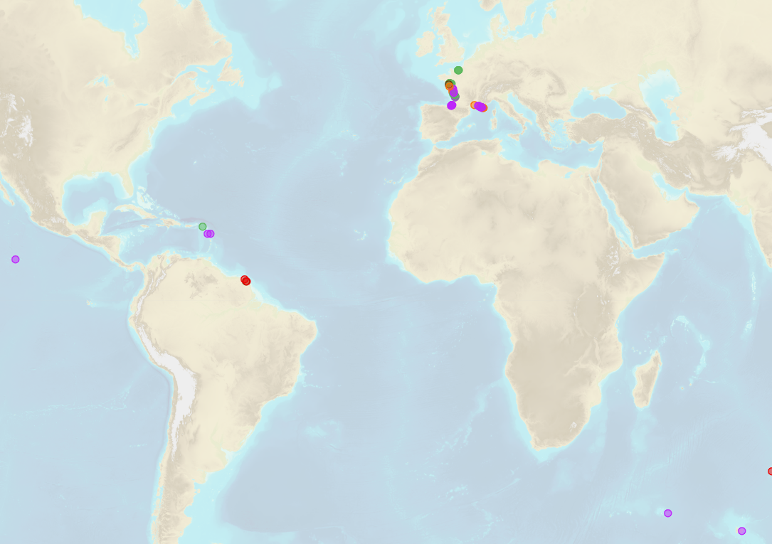
Shom is the national referent for the level of the sea in situ on all areas under French jurisdiction. In this capacity, he assures under the acronym REFMAR different coordination functions in the collection and dissemination of public data related to water level observations, in order to promote their use in multiple applications within the framework of international recommendations.
-

Shom manages a network of permanent digital coastal tide-gauges on French coasts: the RONIM Sea Level Observation Network. Most tide-gauge observatories are partnered with one or more local partners.<br /><br /> Four main types of data are available for download:<br /> - “Raw high frequency" data: raw observations neither validated nor evaluated, obtained directly from the sensor. 1-minute measurement; integration time 15 seconds (on the minute); sampling period: 1 second.<br /><br /> - "Raw non-real time" data: raw observations neither validated nor evaluated, obtained directly from the sensor. 10-minute measurement; integration time 121 seconds (around every 10 minutes); sampling period: 1 second.<br /><br /> - "Validated non-real time" data: observations checked and validated by Shom from the "Raw non-real time" data. 10-minute measurement; integration time 121 seconds (around every 10 minutes); sampling period: 1 second.<br /><br /> - "Validated hourly" data: observations checked and validated by Shom, generated from "Validated non-real time" data. Hourly measurement obtained from the Vondrak filter with triangular weighting. The hourly height cannot be calculated in the event of an observation gap greater than 1.5 hours.
-
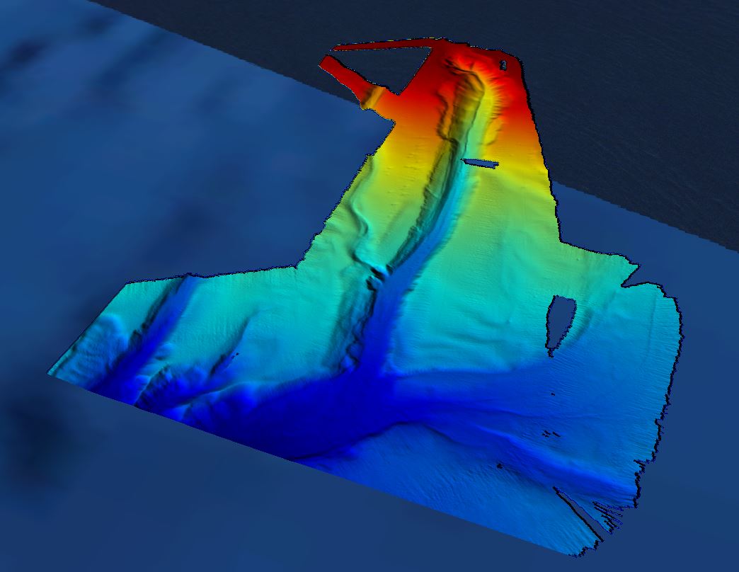
Grid processed for the purpose of the HR DTMs layer of EMODnet Bathymetry HRSM, October 2018
-
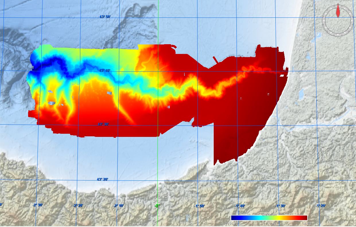
Conversion into the EMODnet format of the published grid for the Capbreton Canyon in 2007: http://dx.doi.org/10.12770/72e2f750-c255-11df-a9b6-005056987263
-

Shom uses HYCOM 3D (Hybrid Coordinate Ocean Model) digital models to model changes to the ocean environment (currents, temperature, salinity, water depth). These HYCOM 3D models include a scalable (space and time) vertical grid, which is particularly suitable for the coastal regions and physical phenomena modelled (particularly the transition from a deep sea zone to the continental shelf, and the presence of frontal zones). These models were adapted to coastal models at Shom, particularly by integrating tides and the effects of rivers. These models focus on changes and variability in the different physical processes affecting coastal areas (continental shelves and slopes), such as tidal fronts, river plumes, tides and internal waves, upwelling and the dynamics of the mixed layer at an hourly frequency and with high spatial resolution (1/60 deg for the Biscay Channel model).
-
-
This dataset presents the estimated multiplication factor by which the frequency of flooding events of a given height in European tide gauges will change between 2010 and 2100, due to projected regional sea relative level rise under the Representative Concentration Pathways (RCP) 4.5 scenario. Values larger than 1 indicate an increase in flooding frequency. This dataset is derived from the Figure 13.25(b) of the Working Group I contribution to the IPCC Fifth Assessment Report (http://www.climatechange2013.org/images/report/WG1AR5_ALL_FINAL.pdf). This dataset also contributes to an earlier version of the EEA Indicator "Global and European sea-level": https://www.eea.europa.eu/data-and-maps/indicators/sea-level-rise-5/assessment.
-
The in-situ TAC integrates and quality control in a homogeneous manner in situ data from outside Copernicus Marine Environment Monitoring Service (CMEMS) data providers to fit the needs of internal and external users. It provides access to integrated datasets of core parameters for initialization, forcing, assimilation and validation of ocean numerical models which are used for forecasting, analysis and re-analysis of ocean physical and biogeochemical conditions. The in-situ TAC comprises a global in-situ centre and 6 regional in-situ centres (one for each EuroGOOS ROOSs). The focus of the CMEMS in-situ TAC is on parameters that are presently necessary for Copernicus Monitoring and Forecasting Centres namely temperature, salinity, sea level, current, waves, chlorophyll / fluorescence, oxygen and nutrients. The initial focus has been on observations from autonomous observatories at sea (e.g. floats, buoys, gliders, ferrybox, drifters, and ships of opportunity). The second objective was to integrate products over the past 25 to 50 years for re-analysis purposes... Gathering data from outsider organisations requires strong mutual agreements. Integrating data into ONE data base requires strong format standard definition and quality control procedures. The complexity of handling in situ observation depends not only on the wide range of sensors that have been used to acquire them but, in addition to that, the different operational behaviour of the platforms (i.e vessels allow on board human supervision, while the supervision of others should be put off until recovering or message/ping reception)°